

View all Long Beach apartments on a map.
Long Beach is about 25 miles south of Los Angeles; as part of the spread out ecosystem of greater Los Angeles, it’s got some of the commuter challenges you might expect from any Southern California city. But it’s possible to have a walking and transit friendly life in this beach side city. Metro Rail runs into LA and Long Beach Transit provides extensive bus service. Long Beach has great biking and won an award for their “green lane” project – a program designating safe places for cyclists in traffic – in 2010.
Long Beach has the country’s second largest shipping port and there’s oil here too – you’ll see the rigs offshore. Boeing and Verizon are big employers in the region. The Queen Mary, a classic ocean liner, is docked in Long Beach and the Catalina Express leaves from the waterfront to Catalina Island several times a day.
Most errands can be accomplished on foot.


Rose Park

Los Cerritos Park
Long Beach is the 10th most walkable large city in the US with 462,257 residents.
Long Beach has some public transportation and is very bikeable.
Find apartments in Long Beach's most walkable neighborhoods: Belmont Shore, Central Long Beach and Belmont Heights.
View all Long Beach apartments on a map.
Rank # | Name | Walk Score | Transit Score | Bike Score |
|---|---|---|---|---|
| 1 | Belmont Shore | 89 | 34 | 75 |
| 2 | Central Long Beach | 87 | 56 | 70 |
| 3 | Belmont Heights | 86 | 41 | 72 |
| 4 | Southeast Wrigley | 86 | 62 | 76 |
| 5 | Washington School | 86 | 67 | 80 |
| 6 | Bixby Park | 86 | 56 | 79 |
| 7 | Bluff Park | 85 | 42 | 81 |
| 8 | Willmore City | 83 | 67 | 87 |
| 9 | Belmont Park | 81 | 35 | 78 |
| 10 | Addams | 80 | 51 | 65 |
| 11 | Traffic Circle | 79 | 48 | 68 |
| 12 | South Wrigley | 79 | 56 | 80 |
| 13 | Dairy | 75 | 47 | 60 |
| 14 | California Heights | 75 | 50 | 67 |
| 15 | Naples | 73 | 32 | 68 |
| 16 | Westside | 72 | 43 | 60 |
| 17 | Lindbergh | 72 | 41 | 70 |
| 18 | Bixby Knolls | 72 | 45 | 74 |
| 19 | Lower Westside | 71 | 46 | 80 |
| 20 | Jordan | 69 | 41 | 76 |
| 21 | Sutter | 67 | 53 | 59 |
| 22 | Imperial Estates South | 66 | 37 | 73 |
| 23 | Sunrise Park | 66 | 58 | 64 |
| 24 | College Square | 66 | 54 | 62 |
| 25 | Carmelitos | 65 | 45 | 73 |
| 26 | Artesia Freeway Corridor | 65 | 40 | 67 |
| 27 | Upper Westside | 62 | 39 | 55 |
| 28 | Stearns Park | 61 | 41 | 63 |
| 29 | Memorial Heights | 59 | 60 | 66 |
| 30 | Lakewood Village | 59 | 40 | 65 |
| 31 | Park Estates | 59 | 53 | 72 |
| 32 | Cherry Manor | 59 | 37 | 68 |
| 33 | North Wrigley | 58 | 54 | 72 |
| 34 | Freeway Circle | 58 | 52 | 56 |
| 35 | Alamitos Heights | 57 | 55 | 69 |
| 36 | Los Cerritos | 54 | 54 | 65 |
| 37 | Deforest Park | 53 | 47 | 64 |
| 38 | Longwood | 53 | 53 | 52 |
| 39 | Coolidge Triangle | 52 | 52 | 54 |
| 40 | Seadip | 50 | 48 | 67 |
| 41 | Cal State University Long Beach | 50 | 52 | 75 |
| 42 | Hamilton | 43 | 41 | 69 |
| 43 | South of Conant | 42 | 35 | 67 |
| 44 | El Dorado Park Estates | 41 | 36 | 63 |
| 45 | Arlington | 41 | 38 | 46 |
| 46 | College Estates | 38 | 40 | 73 |
| 47 | Wrigley Heights | 37 | 55 | 61 |
| 48 | Atherton South | 35 | 37 | 75 |
| 49 | The Lakes | 35 | 37 | 62 |
| 50 | Rancho Estates | 34 | 31 | 62 |
| 51 | Bixby Hill | 29 | 53 | 63 |
| 52 | El Dorado Park South | 24 | 34 | 67 |
There are about 1,373 restaurants, bars and coffee shops in Long Beach.
People in Long Beach can walk to an average of 4 restaurants, bars and coffee shops in 5 minutes.
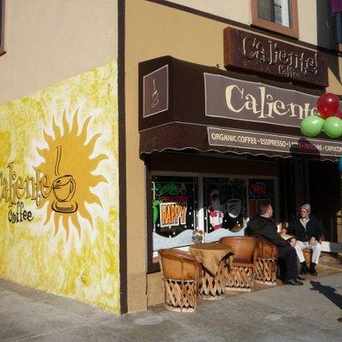
Coffee Caliente

Naples Rib Company- Lo
A few nearby public transportation options. Find Long Beach apartments for rent near public transit.
Long Beach has some public transportation and about 50 bus and 1 light rail lines.
The map above shows how far you can travel in 30 minutes from Long Beach on public transit.
Thinking of renting an apartment or buying in Long Beach? Ask our neighborhood guides a question.


Biking is convenient for most trips.

51 Sicilian Way, Long Beach, CA 90803

Butterfly Beach, Montecito, CA,

Parking

Napalm Canal
 Walking on Broadway you get the freshness from the Ocean. If you look down the street you can see the ocean just a few blocks away.

Martin N
on Broadway and MiraMar

Belmont Pier

Cal Heights Mural

Cal Heights Street Scene

9th Place Beach Entrance
 The Cal Heights mural is a project of the California Heights Neighborhood Association, installed to improve the entrance to the neighborhood in 2004. Painted by artists Art Mortimer, the mural was prepped by neighborhood volunteers to reduce the cost. The mural is visible from the popular Blackbird Café, Hole' Mole' Tacos, Vintage Emporium and Orange Avenue Salvage.
John A Royce
on Cal Heights Mural

Child Net Youth & Family Services

Villa Pacifica Condos

Marbrisa Apartment Homes
 Olive Avenue is a popular street for walking on warm days with its Camphor tree cathedral of green!
John A Royce
on Cal Heights Street Scene

Add Walk Score, Bike Score, and Transit Score to your rental and for sale properties with the Walk Score Widget.

Build apps with Walk Score, public transit data, and commute and travel times via Walk Score APIs.

Use Walk Score data for real estate, public health, finance, and urban planning research and analysis.
If you are using a screen reader or having trouble reading this website, please call Walk Score customer service at (253) 256-1634.
© 2026 Walk Score


Chrystine G
on Bluff Park