Walk Score Logo
Go
Locate me

Living in Irving

Irving has an average Walk Score of 45 with 216,290 residents.

Irving has some public transportation and does not have many bike lanes.

The most walkable Irving neighborhoods are Plymouth Park, Espanita and Plymouth Park North.

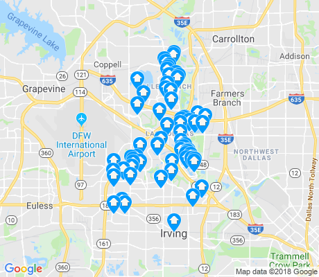
Nearby Irving Apartments on Redfin

45 Walk Score of Irving, TX

Irving is a Car-Dependent city

Most errands require a car.

Walk Score Map

25
100

Most errands require a car in Irving.

Irving Apartments for Rent

Irving Neighborhoods

Rank

#

Name

Walk Score

Transit Score

Bike Score

Population

1 Plymouth Park 71 29 51 2,449
2 Espanita 67 29 48 589
3 Plymouth Park North 64 26 52 1,899
4 Hillcrest Oaks 63 27 53 2,908
5 Nichols Park 61 30 48 4,781
6 Song 58 28 45 4,285
7 Hospital District 57 32 44 970
8 Cardinal Village 55 32 48 1,398
9 Northwest Park 55 29 44 4,174
10 Garden Oaks 54 32 47 1,384
11 Barton Estates 53 30 49 2,091
12 Country Club Estates 51 24 42 1,005
13 Valley Ranch 50 26 43 25,427
14 Arts District 48 23 45 5,592
15 South Austin Heights 46 43 56 990
16 Sherwood Forest 44 27 45 1,848
17 Woodhaven 44 29 43 1,375
18 Lamar Brown 42 25 40 5,294
19 Owen Point 38 29 46 2,896
20 North Austin Heights 37 31 45 2,016
21 Legends 33 33 38 738
22 Bear Creek 33 32 39 1,917
23 Grauwyler Heights 30 27 43 2,442
24 Irving Heights 30 26 40 1,284
25 Pioneer Valley Estates 29 31 30 523
26 Townlake 26 32 33 711
27 Hackberry Creek 21 16 27 3,484
28 Las Brisas 15 26 28 1,556
29 Broadmoor Hills 4 8 21 548

Eating & Drinking

There are about 651 restaurants, bars and coffee shops in Irving.

People in Irving can walk to an average of 0.5 restaurants, bars and coffee shops in 5 minutes.

Restaurant Choices Map

= More Choices

29 Transit Score of Irving, TX

Irving has Some Transit

A few nearby public transportation options. Find Irving apartments for rent on Redfin.

Public Transit Routes

Irving has some public transportation and about 6 bus, 1 rail and 2 light rail lines.

Transit Time

The map above shows how far you can travel in 30 minutes from Irving on public transit.

42 Bike Score of Irving, TX

Irving is Somewhat Bikeable

Minimal bike infrastructure.

25
100
Bike
Score

     o__
    _.>/ _
___(_)_\(_)___
          
Bike
Lanes

________________
 __  __  __  __
________________
          
Hills
          _
         / \
   _   _/   \
__/ \_/      \__
          
Bike
Commuters
              _
             |_|
/\           |_|
[]...........|_|
          

Irving is Talking About...

play money f o o d car dallas god team drink school walk job sleep movie party in the fight tired eat texas song

Irving is all about:

Tweet @WalkScore

Walk Score Professional

Real Estate

Walk Score Neighborhood Map

Add Walk Score, Bike Score, and Transit Score to your rental and for sale properties with the Walk Score Widget.

Software Developers

Walk Score APIs

Build apps with Walk Score, public transit data, and commute and travel times via Walk Score APIs.

Data and Analysis

Walk Score Data and Research

Use Walk Score data for real estate, public health, finance, and urban planning research and analysis.