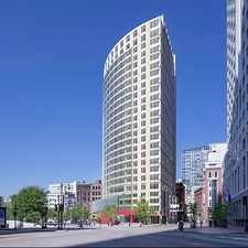
112 Myrtle Street
Daily errands do not require a car.
World-class public transportation.
Some hills, excellent bike lanes.
About your score
112 Myrtle Street has a Walk Score of 98 out of 100. This location is a Walker’s Paradise so daily errands do not require a car.
112 Myrtle Street is a four minute walk from the Red Line at the Charles/MGH Station - Inbound stop.
This location is in the Beacon Hill neighborhood in Boston. Nearby parks include Louisburg Square, Boston African-American National Historic Site and Phillips Street Play Area.
Explore how far you can travel by car, bus, bike and foot from 112 Myrtle Street.
112 Myrtle Street is a Rider’s Paradise which means world-class public transportation. Car sharing is available from Zipcar and Enterprise CarShare.
Rail lines:
Red Line
0.2 mi
Blue Line
0.4 mi
Green Line
0.4 mi
Bus lines:
43
0.2 mi
55
0.2 mi
39
0.3 mi
15
0.3 mi
57
0.3 mi
277
0.4 mi
SL5 Silver Line SL5
0.4 mi
352
0.5 mi
354
0.5 mi
93
0.5 mi
Car shares:
Bike shares:
112 Myrtle Street is in the Beacon Hill neighborhood. Beacon Hill is the 3rd most walkable neighborhood in Boston with a neighborhood Walk Score of 98.
Moving to Boston from another city? View our moving to Boston guide.

George Washington Statue
Louisburg Square
Park Street School


If you are using a screen reader or having trouble reading this website, please call Walk Score customer service at (253) 256-1634.
© 2024 Walk Score