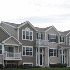
1450 Plymouth Lane
Most errands require a car.
A few nearby public transportation options.
About your score
1450 Plymouth Lane has a Walk Score of 44 out of 100. This location is a Car-Dependent neighborhood so most errands require a car.
This location is in Elgin. Nearby parks include Eagles Forest Preserve, Wing Park and Zayres Park.
Explore how far you can travel by car, bus, bike and foot from 1450 Plymouth Lane.
1450 Plymouth Lane has some transit which means a few nearby public transportation options.
Rail lines:
MD-W Milwaukee West
1.2 mi
Bus lines:
547 Wing Park
0.2 mi
548 Highland
0.3 mi
This location is in the city of Elgin, IL. Elgin has an average Walk Score of 40 and has 108,188 residents.
Learn More About Elgin


If you are using a screen reader or having trouble reading this website, please call Walk Score customer service at (253) 256-1634.
© 2024 Walk Score