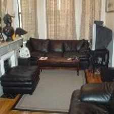
21 Searle Avenue
Most errands can be accomplished on foot.
Transit is convenient for most trips.
Score Details
21 Searle Avenue has a Walk Score of 89 out of 100. This location is Very Walkable so most errands can be accomplished on foot.
21 Searle Avenue is a six minute walk from the Green Line at the Brookline Hills Station - Outbound stop.
This location is in Brookline. Nearby parks include Soldiers Monument, White Place Historic District and Emerson Garden.
Nearby schools include Pierce School, St Mary Of The Assumption Elementary School and Brookline High School.
The closest grocery stores are Edible Arrangements, Stop & Shop and Kurkman's Market Co.
Nearby coffee shops include Cutty's, Dunkin' Donuts and Starbucks. There are 39 restaurants within a 15 minute walk including Virginia's Fine Foods, Olecito and Grano Neapolitian Pizza.
21 Searle Avenue is near Linden Park, Griggs Park and Walnut Place.
Explore how far you can travel by car, bus, bike and foot from 21 Searle Avenue.
21 Searle Avenue has excellent transit which means transit is convenient for most trips. Car sharing is available from Zipcar and RelayRides.
Rail lines:
Green Line
0.3 mi
Bus lines:
65
0.1 mi
66
0.2 mi
60
0.3 mi
51
0.3 mi
Car shares:
Bike shares:
This location is in the city of Brookline, MA. Brookline has an average Walk Score of 79 and has 58,732 residents.

John E Murphy Park
Student Village 2
Jean B Waldstein Playground


If you are using a screen reader or having trouble reading this website, please call Walk Score customer service at (253) 256-1634.
© 2024 Walk Score