Some errands can be accomplished on foot.
Many nearby public transportation options.
Flat as a pancake, excellent bike lanes.
Score Details
This location has a Walk Score of 68 out of 100. This location is Somewhat Walkable so some errands can be accomplished on foot.
This location is a 15 minute walk from the MRL REGULAR METRORAIL SCHEDULE at the VIZCAYA STATION RAIL NORTHBOUND stop.
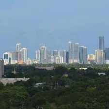
This location is in the Coral Way neighborhood in Miami. Nearby parks include Vizcaya Park, Alice C Wainwright Park and Simpson Park.
Explore how far you can travel by car, bus, bike and foot from this location.
This location has good transit which means many nearby public transportation options. Car sharing is available from RelayRides, Zipcar and WeCar.
Rail lines:
MRL REGULAR METRORAIL SCHEDULE
0.7 mi
MMO METROMOVER OMNI/BRICKELL OUTER LOOP
0.9 mi
Bus lines:
102 B-BRICKELL STATION-KEY BISCAYNE
0.1 mi
48 BRICKELL-UNIV. STA. VIA S. BAYSHORE
0.1 mi
12 NORTHSIDE - MERCY HOSP.
0.2 mi
Car shares:
This location is in the Coral Way neighborhood. Coral Way is the 8th most walkable neighborhood in Miami with a neighborhood Walk Score of 74.
Moving to Miami from another city? View our moving to Miami guide.

Tree Lined Streets
Best Pet Nutrition
Old Vines Wine & Spirits


If you are using a screen reader or having trouble reading this website, please call Walk Score customer service at (253) 256-1634.
© 2024 Walk Score