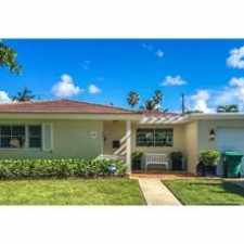
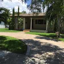
3410 Poinciana Avenue
Southwest Coconut Grove, Miami, 33133
Commute to Downtown Coral Gables
Most errands require a car.
A few nearby public transportation options.
Flat as a pancake, good bike lanes.
About your score
3410 Poinciana Avenue has a Walk Score of 32 out of 100. This location is a Car-Dependent neighborhood so most errands require a car.
This location is in the Southwest Coconut Grove neighborhood in Miami. Nearby parks include The Barnacle Historic State Park, Grapeland Heights Park and Coconut Grove Mini Park.
Explore how far you can travel by car, bus, bike and foot from 3410 Poinciana Avenue.
3410 Poinciana Avenue has some transit which means a few nearby public transportation options.
Rail lines:
RAIL REGULAR METRORAIL SCHEDULE
1.0 mi
Bus lines:
37 HIALEAH-SO.MIAMI VIA PALM/37 AVE
0.3 mi
249 COCONUT GROVE CIRCULATOR
0.6 mi
48 BRICKELL-UNIV. STA. VIA S. BAYSHORE
0.6 mi
3410 Poinciana Avenue is in the Southwest Coconut Grove neighborhood. Southwest Coconut Grove is the 13th most walkable neighborhood in Miami with a neighborhood Walk Score of 64.
Moving to Miami from another city? View our moving to Miami guide.


If you are using a screen reader or having trouble reading this website, please call Walk Score customer service at (253) 256-1634.
© 2024 Walk Score