
9 Bowdoin Street
Most errands can be accomplished on foot.
Transit is convenient for most trips.
Mostly flat, minimal bike lanes.
Score Details
9 Bowdoin Street has a Walk Score of 81 out of 100. This location is Very Walkable so most errands can be accomplished on foot.
9 Bowdoin Street is a nine minute walk from the Fairmount Line and the Franklin Line at the Four Corners / Geneva stop.
This location is in the South Dorchester neighborhood in Boston. Nearby parks include Corbett Park, Mothers Rest and Wellesley Park.

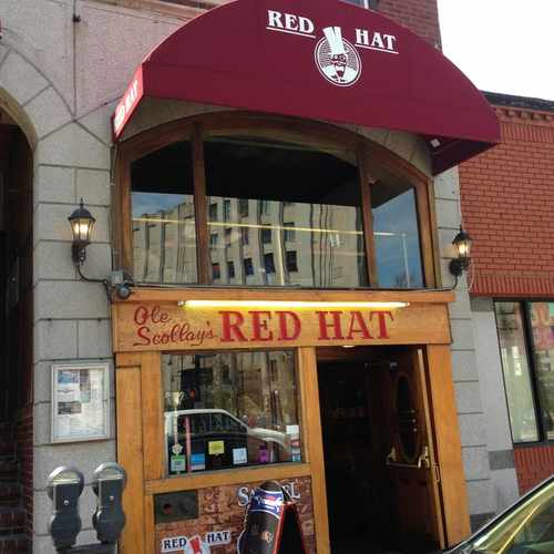
Local bar. Serves Samuel Adams and variety of other beers and alcohol. Great local bar
Explore how far you can travel by car, bus, bike and foot from 9 Bowdoin Street.
9 Bowdoin Street has excellent transit which means transit is convenient for most trips. Car sharing is available from Zipcar, RelayRides and Enterprise CarShare.
Rail lines:
Franklin Line
0.4 mi
Fairmount Line
0.4 mi
Red Line
0.6 mi
Mattapan High-Speed Line
1.1 mi
Bus lines:
23
0.0 mi
19
0.3 mi
15
0.3 mi
17
0.3 mi
Car shares:
9 Bowdoin Street is in the South Dorchester neighborhood. South Dorchester is the 17th most walkable neighborhood in Boston with a neighborhood Walk Score of 81.
Moving to Boston from another city? View our moving to Boston guide.

Parkview Inn
Mothers Rest
Doherty Gibson Playground


If you are using a screen reader or having trouble reading this website, please call Walk Score customer service at (253) 256-1634.
© 2024 Walk Score


Voula Paras