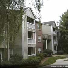
$1,405 2 bed Marietta Street Artery Atlanta GA
Previously Listed $1,405 2 bed
Marietta Street Artery Atlanta GA, Marietta Street Artery, Atlanta, 30318
Commute to Downtown Atlanta

Marietta Street Artery, Atlanta, 30318
Most errands can be accomplished on foot.
A few nearby public transportation options.
Flat as a pancake, excellent bike lanes.
About your score
Explore how far you can travel by car, bus, bike and foot from 935M.
935M has some transit which means a few nearby public transportation options. Car sharing is available from Zipcar and RelayRides.
Rail lines:
GREEN GREEN-Proctor Creek Line
1.2 mi
RED RED-North South North Springs Line
1.3 mi
GOLD GOLD-Northeast Doraville Line
1.3 mi
BLUE BLUE-East/West Line
1.5 mi
Bus lines:
1 Centennial Oly. Park/Coronet Way
0.1 mi
12 Howell Mill Rd/Cumberland
0.2 mi
58 Atlanta Industrial/Hollywood Rd
1.2 mi
26 Perry Boulevard/North Avenue
1.2 mi
50 Donald E Hollowell Pkwy.
1.2 mi
37 Defoors Ferry Rd./Atlantic Station
1.5 mi
110 Peachtree St./"The Peach"
1.5 mi
Car shares:
935 Marietta Street NW compared to all of Atlanta.
Lower crime area.
Lower crime area.
How do you feel walking near 935 Marietta Street NW?
Day:
Night:
Thanks for your feedback!
935M is in the Marietta Street Artery neighborhood. Marietta Street Artery is the 14th most walkable neighborhood in Atlanta with a neighborhood Walk Score of 78.
Moving to Atlanta from another city? View our moving to Atlanta guide.

Brickworks Atlanta at Midtown West
Bocado
HopCity Craft Beer & Wine


If you are using a screen reader or having trouble reading this website, please call Walk Score customer service at (253) 256-1634.
© 2024 Walk Score