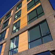
Southeast 9th Avenue
Sellwood-Moreland, Portland, 97202
Commute to Downtown Portland
Most errands can be accomplished on foot.
Many nearby public transportation options.
Mostly flat, good bike lanes.
About your score
Southeast 9th Avenue has a Walk Score of 80 out of 100. This location is Very Walkable so most errands can be accomplished on foot.
Southeast 9th Avenue is a 11 minute walk from the MAX Orange Line at the SE 17th Ave & Rhine St MAX Station stop.
This location is in the Sellwood-Moreland neighborhood in Portland. Nearby parks include Brooklyn City Park, Brooklyn School Park and Powell City Park.
Explore how far you can travel by car, bus, bike and foot from Southeast 9th Avenue.
Southeast 9th Avenue has good transit which means many nearby public transportation options. Car sharing is available from Getaround, Zipcar and RelayRides.
Rail lines:
MAX Orange Line
0.4 mi
Portland Streetcar - NS Line
0.7 mi
Portland Streetcar - B Loop
0.7 mi
Portland Streetcar - A Loop
0.7 mi
Bus lines:
19 Woodstock/Glisan
0.2 mi
9 Powell Blvd
0.3 mi
66 Marquam Hill/Hollywood
0.3 mi
17 Holgate/Broadway
0.3 mi
70 12th/NE 33rd Ave
0.3 mi
291 Orange Night Bus
0.4 mi
35 Macadam/Greeley
0.7 mi
36 South Shore
0.7 mi
Car shares:
Southeast 9th Avenue compared to all of Portland.
Lower crime area.
Lower crime area.
How do you feel walking near Southeast 9th Avenue?
Day:
Night:
Thanks for your feedback!
Southeast 9th Avenue is in the Sellwood-Moreland neighborhood. Sellwood-Moreland is the 24th most walkable neighborhood in Portland with a neighborhood Walk Score of 79.
Moving to Portland from another city? View our moving to Portland guide.

Tea Chai Té
Funky Puffs food cart
Savory Spice Shop


If you are using a screen reader or having trouble reading this website, please call Walk Score customer service at (253) 256-1634.
© 2024 Walk Score