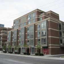
142 Redpath Avenue
Mount Pleasant West, Toronto, M4P 2K4
Commute to Downtown Toronto
Daily errands do not require a car.
World-class public transportation.
Flat as a pancake, some bike lanes.
About your score
142 Redpath Avenue has a Walk Score of 96 out of 100. This location is a Walker’s Paradise so daily errands do not require a car.
142 Redpath Avenue is a nine minute walk from the 1 LINE 1 (YONGE-UNIVERSITY) at the EGLINTON STATION - SOUTHBOUND PLATFORM stop.
This location is in the Mount Pleasant West neighborhood in Toronto. Nearby parks include St. Clements-Yonge Parkette, Sherwood Park and Glebe Manor Square West.
Explore how far you can travel by car, bus, bike and foot from 142 Redpath Avenue.
142 Redpath Avenue is a Rider’s Paradise which means world-class public transportation. Car sharing is available from Zipcar.
Rail lines:
1 LINE 1 (YONGE-UNIVERSITY)
0.6 km
512 ST. CLAIR
2.3 km
Bus lines:
141 DOWNTOWN/MT.PLEASANT EXPRESS
0.0 km
51 LESLIE
0.1 km
334 EGLINTON EAST NIGHT BUS
0.1 km
354 LAWRENCE EAST NIGHT BUS
0.1 km
56 LEASIDE
0.1 km
54 LAWRENCE EAST
0.1 km
34 EGLINTON EAST
0.1 km
74 MOUNT PLEASANT
0.2 km
312 ST.CLAIR-JUNCTION NIGHT BUS
2.3 km
88 SOUTH LEASIDE
2.3 km
Car shares:
142 Redpath Avenue is in the Mount Pleasant West neighborhood. Mount Pleasant West is the 6th most walkable neighborhood in Toronto with a neighborhood Walk Score of 95.


If you are using a screen reader or having trouble reading this website, please call Walk Score customer service at (253) 256-1634.
© 2024 Walk Score