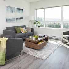
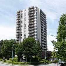
2826-2886 Columbia Street
Mount Pleasant, Vancouver, V5Y 1T8
Commute to Downtown Vancouver
Daily errands do not require a car.
Transit is convenient for most trips.
Mostly flat, excellent bike lanes.
About your score
2826-2886 Columbia Street has a Walk Score of 95 out of 100. This location is a Walker’s Paradise so daily errands do not require a car.
2826-2886 Columbia Street is a nine minute walk from the 980 CANADA LINE SKYTRAIN at the BROADWAY-CITY HALL STATION stop.
This location is in the Mount Pleasant neighborhood in Vancouver. Nearby parks include Major Matthews Park, Mount Pleasant Park and Jonathan Rogers Park.
Explore how far you can travel by car, bus, bike and foot from 2826-2886 Columbia Street.
2826-2886 Columbia Street has excellent transit which means transit is convenient for most trips. Car sharing is available from Zipcar.
Rail lines:
980 CANADA LINE SKYTRAIN
0.6 km
996 MILLENNIUM SKYTRAIN
1.7 km
999 EXPO SKYTRAIN
1.7 km
980 CANADA LINE SkyTrain
1.9 km
Bus lines:
N9 DOWNTOWN/COQUITLAM STN NIGHTBUS
0.4 km
009 BDRY/COMM-BWY/GRAN/ALMA/UBC
0.4 km
015 CAMBIE/OLYMPIC VILLAGE STN
0.4 km
N15 DOWNTOWN/CAMBIE NIGHTBUS
0.4 km
033 29 AVE STN/ UBC
0.5 km
099 COMMERCIAL-BROADWAY/UBC (B-LINE)
0.6 km
Car shares:
2826-2886 Columbia Street is in the Mount Pleasant neighborhood. Mount Pleasant is the 6th most walkable neighborhood in Vancouver with a neighborhood Walk Score of 88.

Tap & Barrel
Tap & Barrel
John McBride Community Garden


If you are using a screen reader or having trouble reading this website, please call Walk Score customer service at (253) 256-1634.
© 2024 Walk Score