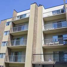
6033 18 Street Southeast
Commute to Downtown Calgary
Most errands require a car.
A few nearby public transportation options.
Flat as a pancake, excellent bike lanes.
About your score
6033 18 Street Southeast has a Walk Score of 47 out of 100. This location is a Car-Dependent neighborhood so most errands require a car.
This location is in the Ogden neighborhood in Calgary.
Explore how far you can travel by car, bus, bike and foot from 6033 18 Street Southeast.
6033 18 Street Southeast has some transit which means a few nearby public transportation options.
Bus lines:
41 Lynnwood
0.2 km
36 Riverbend
0.2 km
24 Ogden
0.2 km
75 Riverbend
0.3 km
6033 18 Street Southeast is in the Ogden neighborhood. Ogden is the 82nd most walkable neighborhood in Calgary with a neighborhood Walk Score of 53.


If you are using a screen reader or having trouble reading this website, please call Walk Score customer service at (253) 256-1634.
© 2024 Walk Score