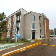
Forest Heights, Edmonton, T6A 2Z2
Commute to Downtown Edmonton
Some errands can be accomplished on foot.
A few nearby public transportation options.
About your score
This location has a Walk Score of 54 out of 100. This location is Somewhat Walkable so some errands can be accomplished on foot.
This location is in the Forest Heights neighborhood in Edmonton. Nearby parks include Capilano Park, Silver Heights Park and Dawson Park.
Explore how far you can travel by car, bus, bike and foot from this location.
This location has some transit which means a few nearby public transportation options.
Bus lines:
881 McNally/Hardisty - Capilano
0.2 km
1 West Edmonton Mall - Downtown - Capilano
0.2 km
866 St Kevin/Hardisty - Capilano
0.2 km
764 Capilano - McNally - Downtown
0.2 km
99 Capilano - Coliseum - Belvedere
0.2 km
780 MWTC - Southwood - Kiniski-AOB/Hardisty
0.2 km
774 Silverberry to Austin O'Brien
0.2 km
785 Wild Rose-Larkspur-Kiniski-Hardisty
0.2 km
779 MWTC - S.Berry - Larkspur -AOB/Hardisty
0.2 km
94 University - Gold Bar - Capilano
0.3 km
This location is in the Forest Heights neighborhood. Forest Heights is the 126th most walkable neighborhood in Edmonton with a neighborhood Walk Score of 50.


If you are using a screen reader or having trouble reading this website, please call Walk Score customer service at (253) 256-1634.
© 2024 Walk Score