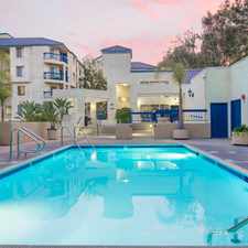
$1,195 1 bed Traffic Circle Long Beach CA
Previously Listed $1,195 1 bed
Traffic Circle Long Beach CA, Bryant School, Long Beach, 90845
Commute to Downtown Long Beach


Bryant School, Long Beach, 90845
Most errands can be accomplished on foot.
Many nearby public transportation options.
Flat as a pancake, excellent bike lanes.
About your score
Explore how far you can travel by car, bus, bike and foot from Traffic Circle Long Beach CA.
Traffic Circle Long Beach CA has good transit which means many nearby public transportation options. Car sharing is available from RelayRides and Zipcar.
Bus lines:
171 PACIFIC COAST HWY./ SEAL BEACH
0.0 mi
121 OCEAN BLVD - CSULB - OUTER CIRCLE
0.0 mi
45 ANAHEIM ST./TO PCH
0.2 mi
46 ANAHEIM ST./ TO PCH
0.2 mi
111 BROADWAY / LAKEWOOD
0.2 mi
112 BROADWAY / CLARK
0.2 mi
173 PCH / STUDEBAKER
0.2 mi
172 PCH / PALO VERDE
0.2 mi
174 PCH / XIMENO
0.2 mi
176 PCH STATION - LAKEWOOD MALL
0.2 mi
Car shares:
Traffic Circle Long Beach CA is in the Bryant School neighborhood. Bryant School is the 10th most walkable neighborhood in Long Beach with a neighborhood Walk Score of 83.
Moving to Long Beach from another city? View our moving to Long Beach guide.


If you are using a screen reader or having trouble reading this website, please call Walk Score customer service at (253) 256-1634.
© 2024 Walk Score