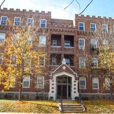
2860 Harrison Avenue
Westwood, Cincinnati, 45211
Commute to Downtown White Oak
Some errands can be accomplished on foot.
A few nearby public transportation options.
Mostly flat, minimal bike lanes.
About your score
2860 Harrison Avenue has a Walk Score of 55 out of 100. This location is Somewhat Walkable so some errands can be accomplished on foot.
This location is in the Westwood neighborhood in Cincinnati. Nearby parks include Westwood Common, Westwood Town Center Historic District and Oakamp Playground.
Explore how far you can travel by car, bus, bike and foot from 2860 Harrison Avenue.
2860 Harrison Avenue has some transit which means a few nearby public transportation options.
Bus lines:
3332 Ferguson - Harrison Ave
0.1 mi
1732 Belmont - Beekman - Harrison
0.1 mi
4313 Seymour - Winton Ter - E Westwood
0.1 mi
1731 Belmont - Montana - Queen City
0.1 mi
4331 Seymour - Millvale - Harrison
0.1 mi
2131 Westwood Northern - Westwood
0.1 mi
2431 Erie - Harrison - Glenway
0.1 mi
4931 Ezzard Charles-Westwood-Cheviot
0.1 mi
21 Westwood - Harrison Avenue
0.1 mi
3314 Ferguson - North Bend
0.1 mi
View all Westwood apartments on a map.

Popular apartment searches include pool and hardwood floor.
2860 Harrison Avenue is in the Westwood neighborhood. Westwood is the 31st most walkable neighborhood in Cincinnati with a neighborhood Walk Score of 39.


If you are using a screen reader or having trouble reading this website, please call Walk Score customer service at (253) 256-1634.
© 2024 Walk Score