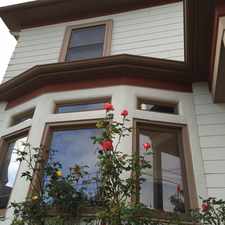
812 58th Street
Most errands can be accomplished on foot.
Many nearby public transportation options.
Flat as a pancake, excellent bike lanes.
About your score
812 58th Street has a Walk Score of 85 out of 100. This location is Very Walkable so most errands can be accomplished on foot.
This location is in the Santa Fe neighborhood in Oakland. Nearby parks include Dover Street Park, Bushrod Park and Greg Brown Park.
Explore how far you can travel by car, bus, bike and foot from 812 58th Street.
812 58th Street has good transit which means many nearby public transportation options. Car sharing is available from RelayRides, Getaround, Zipcar and City CarShare.
Rail lines:
Richmond - Daly City/Millbrae Millbrae
0.6 mi
Fremont - Richmond Richmond
0.6 mi
Pittsburg/Bay Point - SFIA/Millbrae San Francisco Int'l Airport
1.0 mi
Capitol Corridor
1.2 mi
Bus lines:
12 Dtn. Oakland /Dtn. Berkeley
0.0 mi
F San Francisco - Berkeley
0.2 mi
88 Berkeley BART - Downtown Oakland
0.2 mi
18 San Pablo & Monroe - Moraga & Mountain
0.3 mi
Car shares:
812 58th Street compared to all of Oakland.
Lower crime area.
Lowest crime area.
How do you feel walking near 812 58th Street?
Day:
Night:
Thanks for your feedback!
812 58th Street is in the Santa Fe neighborhood. Santa Fe is the 26th most walkable neighborhood in Oakland with a neighborhood Walk Score of 84.
Moving to Oakland from another city? View our moving to Oakland guide.

Martin Luther King Super Stop
A Market
Tamales Unicos de Cuernavaca

If you are using a screen reader or having trouble reading this website, please call Walk Score customer service at (253) 256-1634.
© 2024 Walk Score