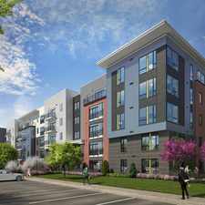
Oakville Ct
Almost all errands require a car.
A few nearby public transportation options.
Very steep hills, minimal bike lanes.
About your score
Oakville Ct has a Walk Score of 17 out of 100. This location is a Car-Dependent neighborhood so almost all errands require a car.
Oakville Ct is a 21 minute walk from the RED Castle Shannon via Beechview at the BROADWAY AVE AT HAMPSHIRE stop.
This location is in the Banksville neighborhood in Pittsburgh. Nearby parks include Wilson Park, Mount Washington Park and West End Park.
Explore how far you can travel by car, bus, bike and foot from Oakville Ct.
Oakville Ct has some transit which means a few nearby public transportation options.
Rail lines:
RED Castle Shannon via Beechview
0.8 mi
BLSV South Hills Village via Overbrook
1.4 mi
BLLB Library via Overbrook
1.4 mi
Bus lines:
36 Banksville
0.3 mi
38 Green Tree
0.4 mi
Y49 Prospect Flyer
1.3 mi
Y46 Elizabeth Flyer
1.3 mi
Y47 Curry Flyer
1.3 mi
Y45 Baldwin Manor Flyer
1.3 mi
39 Brookline
1.3 mi
41 Bower Hill
1.3 mi
Y1 Large Flyer
1.3 mi
Oakville Ct is in the Banksville neighborhood. Banksville is the 66th most walkable neighborhood in Pittsburgh with a neighborhood Walk Score of 33.


If you are using a screen reader or having trouble reading this website, please call Walk Score customer service at (253) 256-1634.
© 2024 Walk Score