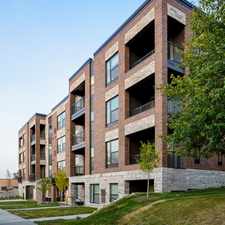
215 Otis Avenue
Merriam Park West, St. Paul, 55104
Commute to Downtown Minneapolis
Most errands require a car.
Steep hills, excellent bike lanes.
About your score
215 Otis Avenue has a Walk Score of 39 out of 100. This location is a Car-Dependent neighborhood so most errands require a car.
This location is in the Merriam Park West neighborhood in St. Paul. Nearby parks include Meeker Island Dog Park, Desnoyer Park and Central Mississippi Riverfront Park.
Explore how far you can travel by car, bus, bike and foot from 215 Otis Avenue.
Rail lines:
Green METRO Green Line
1.1 mi
Bus lines:
21 Uptown - Lake St - Selby Av
0.0 mi
53 Ltd Stop - Uptown - Lake St - Marshall Av
0.0 mi
134 Ltd Stop - Cleveland Av - Cretin Av - Mpls
0.2 mi
63 Grand Av - Raymond Sta - Sunray - McKnight Rd
0.2 mi
87 Rosedale - U of M St Paul - Cleveland Av
0.5 mi
Car shares:
Bike shares:
215 Otis Avenue is in the Merriam Park West neighborhood. Merriam Park West is the 23rd most walkable neighborhood in St. Paul with a neighborhood Walk Score of 55.

Summit Av & Finn St
Summit Av & Finn / Cretin Av
Summit Av & Finn St


If you are using a screen reader or having trouble reading this website, please call Walk Score customer service at (253) 256-1634.
© 2024 Walk Score