
Roberto Clemente Bridge
Pittsburgh, Pennsylvania
Commute to Downtown Pittsburgh
Most errands can be accomplished on foot.
World-class public transportation.
Biking is convenient for most trips.

Roberto Clemente Bridge has a Walk Score of 78 out of 100. This location is Very Walkable so most errands can be accomplished on foot.
Roberto Clemente Bridge is a 16 minute walk from the BLUE, the RED and the SLVR SILVER LINE at the GATEWAY STATION stop.
This location is in Pittsburgh. Nearby parks include PNC Park, Roberto Clemente Memorial Park and Point State Park.

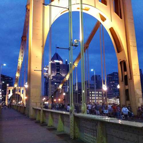
Roberto Clemente Bridge walking from PNC Park towards downtown.
Explore how far you can travel by car, bus, bike and foot from Roberto Clemente Bridge.
Roberto Clemente Bridge is a Rider’s Paradise which means world-class public transportation.
Bus lines:
17 SHADELAND
0.1 mi
16 BRIGHTON
0.1 mi
13 BELLEVUE
0.1 mi
8 PERRYSVILLE
0.1 mi
12 MCKNIGHT
0.2 mi
P13 MOUNT ROYAL FLYER
0.2 mi
15 CHARLES
0.2 mi
2 MOUNT ROYAL
0.2 mi
4 TROY HILL
0.2 mi
6 SPRING HILL
0.2 mi
This location is in the city of Pittsburgh, PA. Pittsburgh has an average Walk Score of 62 and has 305,704 residents.

DUQUESNE INCLINE AT UPPER STATION
Point of View Park
Point of View Park
If you are using a screen reader or having trouble reading this website, please call Walk Score customer service at (253) 256-1634.
© 2026 Walk Score
Christa Ross