

Cherokee Park Road
Cherokee Seneca, Louisville, 40204
Commute to Downtown Strathmoor Manor

Most errands can be accomplished on foot.

A few nearby public transportation options.

Some bike infrastructure.

Cherokee Park Road has a Walk Score of 71 out of 100. This location is Very Walkable so most errands can be accomplished on foot.
This location is in the Cherokee Seneca neighborhood in Louisville. Nearby parks include Barringer Hill, Cherokee Park, Cherokee Triangle Park and Willow Park, Louisville, KY.

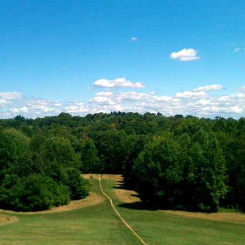
Barringer Hill or "Dog Hill" is a great vantage point to lookout over the entire 400+ acre beauty of Cherokee Park. At the bottom of the Hill you will find a junction of mountain bike and walking trails, an across the creek is "Frisbee Field" or "Rugby Field".
Explore how far you can travel by car, bus, bike and foot from Cherokee Park Road.
Cherokee Park Road has some transit which means a few nearby public transportation options.
Bus lines:
29 Eastern Parkway
0.3 mi
17 Bardstown Road
0.4 mi
23 Broadway
0.4 mi
40 Taylorsville Road
0.4 mi
Cherokee Park Road is in the Cherokee Seneca neighborhood. Cherokee Seneca is the 22nd most walkable neighborhood in Louisville with a neighborhood Walk Score of 60.
Moving to Louisville from another city? View our moving to Louisville guide.
If you are using a screen reader or having trouble reading this website, please call Walk Score customer service at (253) 256-1634.
© 2026 Walk Score
Justin Thomas