
690 American Legion Highway
Commute to Downtown Boston
Most errands can be accomplished on foot.
Many nearby public transportation options.
Some bike infrastructure.

690 American Legion Highway has a Walk Score of 70 out of 100. This location is Very Walkable so most errands can be accomplished on foot.
This location is in the Lower Washington-Mount Hope neighborhood in Boston. Nearby parks include Adams Park, Francis Parkman Playground and Elsie E. Davis Square.

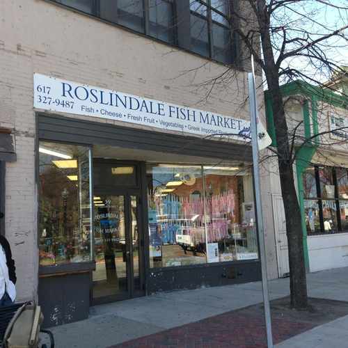
Roslindale fishmarket has imported fish cheese fresh fruit vegetables all Greek imported products directly from Greece unbelievable must try incredible food
Explore how far you can travel by car, bus, bike and foot from 690 American Legion Highway.
690 American Legion Highway has good transit which means many nearby public transportation options.
Rail lines:
Needham Line
1.0 mi
Providence/Stoughton Line
1.2 mi
Franklin/Foxboro Line
1.2 mi
Fairmount Line
1.2 mi
Orange Line
1.2 mi
Bus lines:
14 Roslindale Square - Heath Street
0.1 mi
32 Wolcott or Cleary Square - Forest Hills Station
0.3 mi
33 River Street & Milton Street - Mattapan Station
0.3 mi
30 Mattapan Station - Forest Hills Station via Cummins Highway and Roslindale Square
0.4 mi
690 American Legion Highway is in the Lower Washington-Mount Hope neighborhood. Lower Washington-Mount Hope is the 46th most walkable neighborhood in Boston with a neighborhood Walk Score of 76.
Moving to Boston from another city? View our moving to Boston guide.
If you are using a screen reader or having trouble reading this website, please call Walk Score customer service at (253) 256-1634.
© 2026 Walk Score
Voula Paras