
Miner Street
Daily errands do not require a car.
Many nearby public transportation options.
Biking is convenient for most trips.

Miner Street has a Walk Score of 90 out of 100. This location is a Walker’s Paradise so daily errands do not require a car.
Miner Street is a two minute walk from the UP-NW Union Pacific Northwest at the Des Plaines stop.
This location is in Des Plaines. Nearby parks include Central Park, Potawatomie Park and Rand Park.

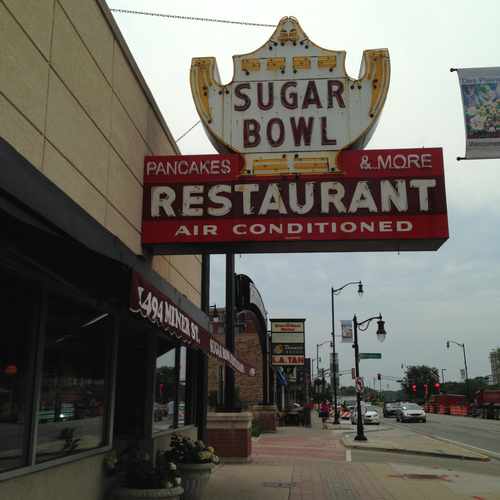
This iconic place has been a popular Des Plaines restaurant since 1921. The place brings in locals for breakfast, lunch, and dinner daily.
Explore how far you can travel by car, bus, bike and foot from Miner Street.
Miner Street has good transit which means many nearby public transportation options.
Rail lines:
UP-NW Union Pacific Northwest
0.1 mi
Bus lines:
250 Dempster Street
0.0 mi
226 Oakton Street
0.0 mi
209 Busse Highway
0.0 mi
Pulse Dempster Line
0.0 mi
208 Golf Road
0.0 mi
234 Wheeling - Des Plaines
0.1 mi
230 South Des Plaines
0.1 mi
This location is in the city of Des Plaines, IL. Des Plaines has an average Walk Score of 57 and has 58,364 residents.

McDonald's Museum
Pesche's Flowers
Sugar Bowl
If you are using a screen reader or having trouble reading this website, please call Walk Score customer service at (253) 256-1634.
© 2026 Walk Score
Allison M