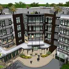
2500 Riverside Farms Rd
Almost all errands require a car.
Many nearby public transportation options.
Mostly flat, some bike lanes.
Score Details
2500 Riverside Farms Rd has a Walk Score of 6 out of 100. This location is a Car-Dependent neighborhood so almost all errands require a car.
This location is in the Pleasant Valley neighborhood in Austin. Nearby parks include Montopolis Park, Mabel Davis Park and McKenney Falls State Park.
Explore how far you can travel by car, bus, bike and foot from 2500 Riverside Farms Rd.
2500 Riverside Farms Rd has good transit which means many nearby public transportation options. Car sharing is available from RelayRides and Getaround.
Bus lines:
331 Oltorf
0.2 mi
411 E-Bus/Riverside
0.3 mi
20 Manor Rd/Riverside
0.3 mi
483 Night Owl Riverside
0.3 mi
Car shares:
2500 Riverside Farms Rd compared to all of Austin.
Average crime area.
Average crime area.
How do you feel walking near 2500 Riverside Farms Rd?
Day:
Night:
Thanks for your feedback!
View all Pleasant Valley apartments on a map.

Popular apartment searches include pool, fitness and furnished.
2500 Riverside Farms Rd is in the Pleasant Valley neighborhood. Pleasant Valley is the 54th most walkable neighborhood in Austin with a neighborhood Walk Score of 33.
Moving to Austin from another city? View our moving to Austin guide.


If you are using a screen reader or having trouble reading this website, please call Walk Score customer service at (253) 256-1634.
© 2026 Walk Score