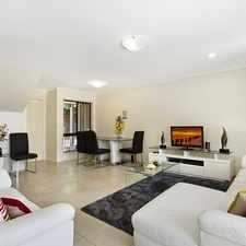
48 Lytton Road
Most errands can be accomplished on foot.
A few nearby public transportation options.
About your score
48 Lytton Road has a Walk Score of 84 out of 100. This location is Very Walkable so most errands can be accomplished on foot.
This location is in the Bulimba neighborhood in Brisbane. Nearby parks include Tugulawa Park, Bulimba Memorial Park and Hamilton Park.
Explore how far you can travel by car, bus, bike and foot from 48 Lytton Road.
48 Lytton Road has some transit which means a few nearby public transportation options.
Rail lines:
BRDB Brisbane City - Doomben line
2.3 km
VLDB Varsity Lakes line - Doomben line
2.3 km
CLDB Cleveland line - Doomben line
2.3 km
DBBR Doomben line - Brisbane City
2.3 km
BNDB Beenleigh line - Doomben line
2.3 km
DBCL Doomben line - Cleveland line
2.3 km
DBBN Doomben line - Beenleigh line
2.3 km
BRCL Brisbane City - Cleveland line
2.4 km
CACL Caboolture line - Cleveland line
2.4 km
SHCL Shorncliffe line - Cleveland line
2.4 km
Bus lines:
232 Cannon Hill - City
0.1 km
P236 Balmoral - City Pre-Paid Express via Thynne Road
0.1 km
235 Balmoral - City/Valley via Thynne Road
0.1 km
230 Balmoral - City via Riding Road
0.1 km
238 Cannon Hill, Hawthorne Ferry, Morningside station
0.1 km
N226 Valley - Wynnum NightLink via Bulimba
0.1 km
P231 Balmoral - City Pre-Paid Express via Riding Road
0.3 km
48 Lytton Road is in the Bulimba neighborhood. Bulimba is the 13th most walkable neighborhood in Brisbane with a neighborhood Walk Score of 83.


If you are using a screen reader or having trouble reading this website, please call Walk Score customer service at (253) 256-1634.
© 2024 Walk Score