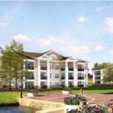
7330 Caversham Way
Almost all errands require a car.
It is possible to get on a bus.
Flat as a pancake, minimal bike lanes.
Score Details
7330 Caversham Way has a Walk Score of 3 out of 100. This location is a Car-Dependent neighborhood so almost all errands require a car.
This location is in Raleigh.
Nearby schools include The Franciscan School and Tutorial Half Christian School.
The closest grocery stores are Lafe Foods and Lowes Foods.
Nearby coffee shops include Starbucks and Caribou Coffee. Nearby restaurants include McDonald's, Alexander Place and Panera Bread.
7330 Caversham Way is near Crabtree Creek Watershed Project, Leesville Road Park and Leesville Community Park.
There are minimal bike lanes and the terrain is flat as a pancake. 7330 Caversham Way is somewhat bikeable, there is minimal bike infrastructure.
Explore how far you can travel by car, bus, bike and foot from 7330 Caversham Way.
Bus lines:
70e CAT - Brier Creek Express
0.9 mi
15 DATA - Alston Ave & Brier Creek
1.4 mi
View all Raleigh apartments on a map.

Popular apartment searches include fitness, fireplace and pool.
This location is in the city of Raleigh, NC. Raleigh has an average Walk Score of 29 and has 403,892 residents.
Pour House The
Roanoke Mini-Park
Anthony's Touch of Italy


If you are using a screen reader or having trouble reading this website, please call Walk Score customer service at (253) 256-1634.
© 2024 Walk Score