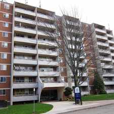
Queen Elizabeth Way
Almost all errands require a car.
A few nearby public transportation options.
About your score
Queen Elizabeth Way has a Walk Score of 8 out of 100. This location is a Car-Dependent neighborhood so almost all errands require a car.
This location is in Hamilton.
Explore how far you can travel by car, bus, bike and foot from Queen Elizabeth Way.
Queen Elizabeth Way has some transit which means a few nearby public transportation options.
Bus lines:
55 STONEY CREEK CENTRAL
0.8 km
This location is in the city of Hamilton, ON. Hamilton has an average Walk Score of 51 and has 519,949 residents.

Herkimer St
Rockview Summit Park
Village Theatre Waterdown


If you are using a screen reader or having trouble reading this website, please call Walk Score customer service at (253) 256-1634.
© 2024 Walk Score