1835 Waterdown Road
Burlington, Ontario, L7P 5A2
Commute to Downtown Burlington
Almost all errands require a car.
A few nearby public transportation options.
About your score
1835 Waterdown Road has a Walk Score of 13 out of 100. This location is a Car-Dependent neighborhood so almost all errands require a car.
This location is in Burlington. Nearby parks include Sealy Park, Sealey Park and St. Thomas Cemetery.
Explore how far you can travel by car, bus, bike and foot from 1835 Waterdown Road.
1835 Waterdown Road has some transit which means a few nearby public transportation options.
Rail lines:
Lakeshore West Train
2.3 km
Bus lines:
18 WATERDOWN
0.2 km
This location is in the city of Burlington, ON. Burlington has an average Walk Score of 54 and has 175,779 residents.
Learn More About Burlington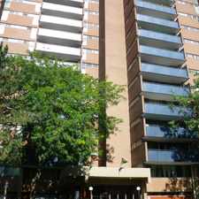


If you are using a screen reader or having trouble reading this website, please call Walk Score customer service at (253) 256-1634.
© 2024 Walk Score