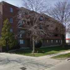
Richmond Hill, Ontario, L4C 3R2
Commute to Downtown Richmond Hill
Most errands require a car.
A few nearby public transportation options.
About your score
This location has a Walk Score of 30 out of 100. This location is a Car-Dependent neighborhood so most errands require a car.
This location is in Richmond Hill. Nearby parks include Pioneer Park, Mill Pond Park and Mount Pleasant Park, Richmond Hill.
Explore how far you can travel by car, bus, bike and foot from this location.
This location has some transit which means a few nearby public transportation options.
Rail lines:
Richmond Hill Train
2.1 km
Bus lines:
83 TRENCH
0.2 km
083A TRENCH
0.2 km
443 LANGSTAFF SS VIA SHAFTSBURY
0.2 km
589 RICHMOND HILL COMMUNITY BUS
0.3 km
590 RICHMOND HILL COMMUNITY BUS
0.3 km
440 ST THERESA SS VIA MILL
0.4 km
240 MILL POND GO SHUTTLE
0.4 km
4 MAJOR MACKENZIE
0.5 km
004A MAJOR MACKENZIE
0.5 km
25 MAJOR MACKENZIE
0.5 km
This location is in the city of Richmond Hill, ON. Richmond Hill has an average Walk Score of 50 and has 185,541 residents.
Learn More About Richmond Hill


If you are using a screen reader or having trouble reading this website, please call Walk Score customer service at (253) 256-1634.
© 2024 Walk Score