


Search for apartments in Jersey City or check out apartments in other Jersey City neighborhoods. Links will open on our partner site Redfin.com.
- Battery Park City, Jersey City apartments for rent
- Bayside, Jersey City apartments for rent
- Bergen-Lafayette, Jersey City apartments for rent
- Brooklyn, Jersey City apartments for rent
- Downtown Jersey City, Jersey City apartments for rent
- Downtown Manhattan, Jersey City apartments for rent
- Exchange Place, Jersey City apartments for rent
- Financial District, Jersey City apartments for rent
- Hamilton Park, Jersey City apartments for rent
- Heights, Jersey City apartments for rent
- Hudson Square, Jersey City apartments for rent
- Journal Square, Jersey City apartments for rent
- McGinley Square, Jersey City apartments for rent
- Newport, Jersey City apartments for rent
- Palisade, Jersey City apartments for rent
- Port Liberté, Jersey City apartments for rent
- SoHo, Jersey City apartments for rent
- The Waterfront, Jersey City apartments for rent
- Tribeca, Jersey City apartments for rent
- West Village, Jersey City apartments for rent


 This is where all the news of jersey city comes from, get the latest Jersey City news and community updates, view photos and videos from this building!


 This place is called Little India. There are so many indian stores from jewelry stores to restaurants to fast food places to video stores, this place is ALWAYS PACKED the sidewalks contain 80 people every minute there is no room for people to walk, but it feels good because the community are very friendly! FOOD IS GREAT!


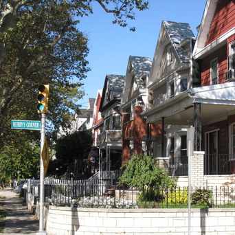
 Hubby's Corner is a historic intersection in the Bergen/Lafayette section of Jersey City, New Jersey. A scenic, residential section of Jersey City, this area is a great place to live, convenient walking distance to public transit and shopping as well as most schools.


Yolanda Cherry
on Infinity Institute