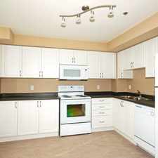
12 Pearson Avenue
Roncesvalles, Toronto, M6R 1G1
Commute to Downtown Toronto
Most errands can be accomplished on foot.
World-class public transportation.
Flat as a pancake, minimal bike lanes.
About your score
12 Pearson Avenue has a Walk Score of 84 out of 100. This location is Very Walkable so most errands can be accomplished on foot.
12 Pearson Avenue is a one minute walk from the 301 QUEEN N.C. and the 501 QUEEN bus at the QUEEN ST WEST AT JAMESON AVE stop.
This location is in the Roncesvalles neighborhood in Toronto. Nearby parks include Sorauren Park, McCormick Park and Masaryk Park.
Explore how far you can travel by car, bus, bike and foot from 12 Pearson Avenue.
12 Pearson Avenue is a Rider’s Paradise which means world-class public transportation. Car sharing is available from Zipcar.
Rail lines:
301 QUEEN N.C.
0.4 km
504 KING
0.6 km
304 KING
0.6 km
Bus lines:
47 LANSDOWNE
0.2 km
501 QUEEN
0.4 km
329 DUFFERIN
0.8 km
29 DUFFERIN
0.8 km
Car shares:
View all Roncesvalles apartments on a map.

12 Pearson Avenue is in the Roncesvalles neighborhood. Roncesvalles is the 14th most walkable neighborhood in Toronto with a neighborhood Walk Score of 91.


If you are using a screen reader or having trouble reading this website, please call Walk Score customer service at (253) 256-1634.
© 2024 Walk Score