1712 Yale St
Most errands can be accomplished on foot.
A few nearby public transportation options.
Flat as a pancake, good bike lanes.
Score Details
1712 Yale St has a Walk Score of 86 out of 100. This location is Very Walkable so most errands can be accomplished on foot.
This location is in the Greater Heights neighborhood in Houston. Nearby parks include Halbert Park, Milroy Park and Love Park.
Explore how far you can travel by car, bus, bike and foot from 1712 Yale St.
1712 Yale St has some transit which means a few nearby public transportation options. Car sharing is available from RelayRides.
Bus lines:
050 HARRISBURG / HEIGHTS
0.1 mi
066 YALE
0.2 mi
027 INNER LOOP CROSSTOWN
0.2 mi
026 OUTER LOOP CROSSTOWN
0.2 mi
Car shares:
1712 Yale St compared to all of Houston.
Lower crime area.
Higher crime area.
How do you feel walking near 1712 Yale St?
Day:
Night:
Thanks for your feedback!
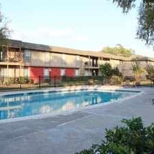
View all Greater Heights apartments on a map.

Popular apartment searches include pool, fitness and furnished.
1712 Yale St is in the Greater Heights neighborhood. Greater Heights is the 8th most walkable neighborhood in Houston with a neighborhood Walk Score of 66.
Moving to Houston from another city? View our moving to Houston guide.
Public House Heights
Canino Produce
Woodland Park


If you are using a screen reader or having trouble reading this website, please call Walk Score customer service at (253) 256-1634.
© 2026 Walk Score