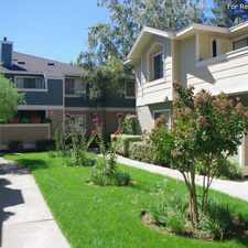
1724 Lucille Lane
Most errands require a car.
Score Details
1724 Lucille Lane has a Walk Score of 30 out of 100. This location is a Car-Dependent neighborhood so most errands require a car.
This location is in Pleasant Hill. Nearby parks include Las Juntas Park, Salfingere Park and Frank Salfingere Park.
Nearby schools include Gregory Gardens Elementary School, College Park High School and Strandwood Elementary School.
The closest grocery stores are Mangini Fruit Stand, Grocery Outlet and Pleasant Hill Market.
Nearby coffee shops include Little RED Bistro, Basement Cafe and Starbucks. Nearby restaurants include Pleasant Hill, CA American Restaurant, Meson Azteca Mexican Cuisine and Yan's Garden.
1724 Lucille Lane is near Frank Salfingere Park, Pinewood Park and Paso Nogal Park.
Explore how far you can travel by car, bus, bike and foot from 1724 Lucille Lane.
Bus lines:
18 AMTRAK/BART Pleasant Hill
0.4 mi
16 AMTRAK/BART Concord
0.6 mi
316 Martinez AMTRAK/BART Pleasant Hill
0.7 mi
9 DVC/BART Walnut Creek
0.7 mi
314 BART Concord/Monument Blvd/DVC
0.7 mi
This location is in the city of Pleasant Hill, CA. Pleasant Hill has an average Walk Score of 48 and has 33,152 residents.
Learn More About Pleasant Hill


If you are using a screen reader or having trouble reading this website, please call Walk Score customer service at (253) 256-1634.
© 2024 Walk Score