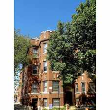
2013 West Greenleaf Avenue
Most errands can be accomplished on foot.
Many nearby public transportation options.
Flat as a pancake, some bike lanes.
About your score
2013 West Greenleaf Avenue has a Walk Score of 77 out of 100. This location is Very Walkable so most errands can be accomplished on foot.
2013 West Greenleaf Avenue is a seven minute walk from the UP-N Union Pacific North at the Rogers Park stop.
This location is in the Rogers Park neighborhood in Chicago. Nearby parks include Paschen Park, Matanky Park and Lunt Park.
Explore how far you can travel by car, bus, bike and foot from 2013 West Greenleaf Avenue.
2013 West Greenleaf Avenue has good transit which means many nearby public transportation options. Car sharing is available from RelayRides, Zipcar, I-GO and Getaround.
Rail lines:
UP-N Union Pacific North
0.3 mi
Red Line
0.7 mi
Yellow Line
0.8 mi
Purple Line
0.8 mi
Bus lines:
96 Lunt
0.1 mi
290 Touhy Avenue
0.2 mi
22 Clark
0.3 mi
Car shares:
2013 West Greenleaf Avenue compared to all of Chicago.
Lower crime area.
Lower crime area.
How do you feel walking near 2013 West Greenleaf Avenue?
Day:
Night:
Thanks for your feedback!
2013 West Greenleaf Avenue is in the Rogers Park neighborhood. Rogers Park is the 26th most walkable neighborhood in Chicago with a neighborhood Walk Score of 85.
Moving to Chicago from another city? View our moving to Chicago guide.

Heartland Cafe
Heartland Cafe
Grill Inn


If you are using a screen reader or having trouble reading this website, please call Walk Score customer service at (253) 256-1634.
© 2024 Walk Score