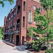
539 Ansley Circle Northeast
Piedmont Heights, Atlanta, 30324
Commute to Downtown North Druid Hills
Most errands can be accomplished on foot.
A few nearby public transportation options.
Some hills, minimal bike lanes.
About your score
539 Ansley Circle Northeast has a Walk Score of 78 out of 100. This location is Very Walkable so most errands can be accomplished on foot.
This location is in the Piedmont Heights neighborhood in Atlanta. Nearby parks include Wildwood Park, Ansley Park and Sidney Marcus Park.
Explore how far you can travel by car, bus, bike and foot from 539 Ansley Circle Northeast.
539 Ansley Circle Northeast has some transit which means a few nearby public transportation options. Car sharing is available from Zipcar and RelayRides.
Rail lines:
RED RED-North South North Springs Line
1.2 mi
GOLD GOLD-Northeast Doraville Line
1.2 mi
Bus lines:
27 Cheshire Bridge Rd/Ansley Mall
0.1 mi
37 Defoors Ferry Rd./Atlantic Station
1.2 mi
110 Peachtree St./"The Peach"
1.2 mi
Car shares:
539 Ansley Circle Northeast compared to all of Atlanta.
Lower crime area.
Lower crime area.
How do you feel walking near 539 Ansley Circle Northeast?
Day:
Night:
Thanks for your feedback!
539 Ansley Circle Northeast is in the Piedmont Heights neighborhood. Piedmont Heights is the 32nd most walkable neighborhood in Atlanta with a neighborhood Walk Score of 66.
Moving to Atlanta from another city? View our moving to Atlanta guide.

Smith's Olde Bar
Ansley Antiques
Ansley Antiques


If you are using a screen reader or having trouble reading this website, please call Walk Score customer service at (253) 256-1634.
© 2024 Walk Score