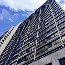
3 Ellis Avenue
Most errands require a car.
Many nearby public transportation options.
Flat as a pancake, excellent bike lanes.
About your score
3 Ellis Avenue has a Walk Score of 37 out of 100. This location is a Car-Dependent neighborhood so most errands require a car.
3 Ellis Avenue is a 28 minute walk from the 506 CARLTON S.C. at the HIGH PARK LOOP stop.
This location is in the South Parkdale neighborhood in Toronto. Nearby parks include High Park, Howard Park Ave entrance and Beaty Boulevard Parkette.
Explore how far you can travel by car, bus, bike and foot from 3 Ellis Avenue.
3 Ellis Avenue has good transit which means many nearby public transportation options. Car sharing is available from Zipcar.
Rail lines:
506 CARLTON S.C.
1.4 km
504 KING S.C.
1.5 km
304 KING N.C.
1.6 km
Bus lines:
80 QUEENSWAY
0.0 km
66 PRINCE EDWARD
0.0 km
145 DOWNTOWN/HUMBER BAY EXPRESS
0.1 km
301 QUEEN N.C.
0.2 km
501 QUEEN S.C.
0.2 km
77 SWANSEA
0.3 km
Car shares:
3 Ellis Avenue is in the South Parkdale neighborhood. South Parkdale is the 35th most walkable neighborhood in Toronto with a neighborhood Walk Score of 83.


If you are using a screen reader or having trouble reading this website, please call Walk Score customer service at (253) 256-1634.
© 2024 Walk Score