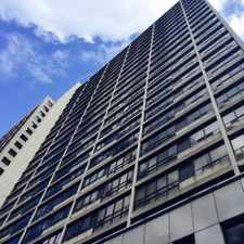
Birchcliffe-Cliffside, Toronto, M1N 1S1
Commute to Downtown Toronto
Most errands can be accomplished on foot.
Many nearby public transportation options.
Flat as a pancake, some bike lanes.
About your score
This location has a Walk Score of 75 out of 100. This location is Very Walkable so most errands can be accomplished on foot.
This location is in the Birchcliffe-Cliffside neighborhood in Toronto. Nearby parks include Scotia Parkette, Birchmount Park and Lynndale Park.
Explore how far you can travel by car, bus, bike and foot from this location.
This location has good transit which means many nearby public transportation options. Car sharing is available from Zipcar.
Rail lines:
2 LINE 2 (BLOOR - DANFORTH)
1.7 km
501 QUEEN S.C.
2.2 km
Bus lines:
69 WARDEN SOUTH
0.1 km
302 KINGSTON RD-McCOWAN NIGHT BUS
0.1 km
12 KINGSTON ROAD
0.1 km
20 CLIFFSIDE
0.5 km
135 GERRARD
0.5 km
301 QUEEN N.C.
2.2 km
143 DOWNTOWN\BEACH EXPRESS
2.2 km
Car shares:
Bike shares:
This location is in the Birchcliffe-Cliffside neighborhood. Birchcliffe-Cliffside is the 67th most walkable neighborhood in Toronto with a neighborhood Walk Score of 71.


If you are using a screen reader or having trouble reading this website, please call Walk Score customer service at (253) 256-1634.
© 2024 Walk Score