Walk Score Logo
Go
Locate me

Living in Bakersfield

Bakersfield has an average Walk Score of 37 with 347,483 residents.

Bakersfield has some public transportation and does not have many bike lanes.

The most walkable Bakersfield neighborhoods are Oleander-Sunset, Riviera-Westchester and Downtown.

Nearby Bakersfield Apartments on Redfin

37 Walk Score of Bakersfield, CA

Bakersfield is a Car-Dependent city

Most errands require a car.

Walk Score Map

25
100
Photo of Beale Park in Bakersfield

Beale Park

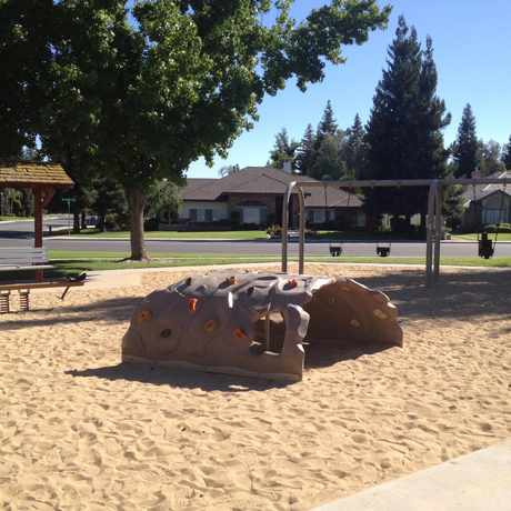
Photo of Haggin Oaks Park in Bakersfield

Haggin Oaks Park

Most errands require a car in Bakersfield.

Bakersfield Apartments for Rent

Bakersfield Neighborhoods

Rank

#

Name

Walk Score

Transit Score

Bike Score

Population

1 Oleander-Sunset 70 36 57 15,196
2 Riviera-Westchester 62 39 61 4,262
3 Downtown 61 39 47 3,247
4 Park Stockdale 59 32 57 6,701
5 Homaker Park 58 32 50 4,871
6 Lakeview 56 32 53 10,392
7 Baker Street 55 29 43 2,070
8 Southgate 52 34 45 6,955
9 Ridgeview Estates 47 25 35 1,929
10 Sagepointe 46 29 52 3,222
11 CSU Bakersfield 45 32 54 2,164
12 Westlakes 43 17 43 2,230
13 Riverlakes 43 21 47 2,618
14 Quailwood 42 30 64 1,899
15 Laurelglen 42 29 44 8,355
16 San Trope 41 19 45 810
17 Fruitvale 37 16 48 6,997
18 Kern City 36 29 43 2,665
19 Stockdale Greens 36 28 63 2,391
20 Amberton 36 26 46 1,462
21 Fairway Oaks 34 19 50 1,797
22 Silver Creek 34 22 36 7,069
23 Haggin Oaks 33 27 37 2,377
24 Stockdale Country Club 33 28 50 1,407
25 The Oaks 33 23 37 4,864
26 Pheasant Run 31 23 51 2,978
27 The Seasons 30 25 37 5,376
28 Stonegate 30 22 32 4,011
29 Crystal Ranch 28 13 40 2,481
30 Madison Grove 26 3 44 2,819
31 Seven Oaks 24 18 38 3,858
32 Westdale Classics 24 19 44 623
33 Avalon 24 15 40 2,943
34 Eagle Ranch 22 16 41 2,022
35 Stockdale West 21 5 48 3,691
36 River Oaks 20 18 51 2,170
37 Emerald Estates 20 18 42 4,583
38 Tevis Ranch 20 0 38 3,564
39 Brighton 19 20 43 1,692
40 Seven Oaks at Grand Island 18 4 40 3,251
41 Hampton Woods 16 2 35 3,027
42 Brimhall Estates 16 20 39 1,249
43 Stone Meadows 13 24 30 5,156
44 Villages of Brimhall-Brimhall Classics 12 19 41 2,359
45 Artisan 11 - 33 3,063
46 Eastridge Estates 11 20 11 1,461
47 Fox Run 11 18 36 2,743
48 Southern Oaks 11 0 32 2,733
49 Stone Creek 10 19 30 1,815
50 Nottingham Estates 9 18 31 1,273
51 Campus Park 9 10 31 2,200
52 Mountain Meadows 9 12 26 718
53 Tyner Homes 8 24 28 3,124
54 Terra Vista 7 - 32 2,940
55 Rio Bravo 7 10 19 1,833
56 City in the Hills 4 3 28 1,584
57 Tuscany 4 13 9 746

Eating & Drinking

There are about 901 restaurants, bars and coffee shops in Bakersfield.

People in Bakersfield can walk to an average of 0.0 restaurants, bars and coffee shops in 5 minutes.

Photo of John's Burgers in Bakersfield

John's Burgers

Photo of La Mina Mexican Restaurant in Bakersfield

La Mina Mexican Restaurant

Restaurant Choices Map

= More Choices

thumbnail for Beale ParkBeale Park is one of the few places in town you can find an outdoor amphitheater complete with built in seating. #oleandersunset

Derian Gordon
on Beale Park

25 Transit Score of Bakersfield, CA

Bakersfield has Some Transit

A few nearby public transportation options. Find Bakersfield apartments for rent on Redfin.

Public Transit Routes

Bakersfield has some public transportation and about 16 bus lines.

Transit Time

The map above shows how far you can travel in 30 minutes from Bakersfield on public transit.

44 Bike Score of Bakersfield, CA

Bakersfield is Somewhat Bikeable

Minimal bike infrastructure.

25
100
Bike
Score

     o__
    _.>/ _
___(_)_\(_)___
          
Bike
Lanes

________________
 __  __  __  __
________________
          
Hills
          _
         / \
   _   _/   \
__/ \_/      \__
          
Bike
Commuters
              _
             |_|
/\           |_|
[]...........|_|
          

Photo of Lowell Park in Bakersfield

Lowell Park

Photo of California State University, Bakersfield in Bakersfield

California State University, Bakersfield

Photo of Beale Park in Bakersfield

Beale Park

Photo of Beale Park in Bakersfield

Beale Park

Photo of Beale Park in Bakersfield

Beale Park

Photo of Beale Park in Bakersfield

Beale Park

thumbnail for Haggin Oaks ParkThis sundial is an awesome neighborhood attribute. It is also the only one I have seen at any of the neighborhood parks I have been to. A very fun an interactive way to get kids engaged an thinking while at the park playing.
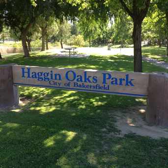
Caitlin McBride
on Haggin Oaks Park

Photo of Haggin Oaks Park in Bakersfield

Haggin Oaks Park

Photo of Haggin Oaks Park in Bakersfield

Haggin Oaks Park

Photo of Haggin Oaks Park in Bakersfield

Haggin Oaks Park

Photo of Haggin Oaks Park in Bakersfield

Haggin Oaks Park

thumbnail for California State University, BakersfieldBeach volleyball, horseshoe pits & BBQ area near student housing

Caitlin McBride
on California State University, Bakersfield

Bakersfield is Talking About...

play eating tired wake song food movie ride drink school walking fight job sleep god party weird dream class car

Bakersfield is all about:

Tweet @WalkScore
Photo of Haggin Oaks Park in Bakersfield

Haggin Oaks Park

Photo of California State University, Bakersfield in Bakersfield

California State University, Bakersfield

Photo of California State University, Bakersfield in Bakersfield

California State University, Bakersfield

thumbnail for Beale ParkBeale Park has 7 different BBQ grills all with ample picnic style seating. #oleandersunset

Derian Gordon
on Beale Park

Walk Score Professional

Real Estate

Walk Score Neighborhood Map

Add Walk Score, Bike Score, and Transit Score to your rental and for sale properties with the Walk Score Widget.

Software Developers

Walk Score APIs

Build apps with Walk Score, public transit data, and commute and travel times via Walk Score APIs.

Data and Analysis

Walk Score Data and Research

Use Walk Score data for real estate, public health, finance, and urban planning research and analysis.