


Search for apartments in Las Vegas or check out apartments in other Las Vegas neighborhoods. Links will open on our partner site Redfin.com.
- Aliante, Las Vegas apartments for rent
- Canyon Gate, Las Vegas apartments for rent
- Centennial Hills, Las Vegas apartments for rent
- Desert Shores, Las Vegas apartments for rent
- Downtown Summerlin, Las Vegas apartments for rent
- Lone Mountain, Las Vegas apartments for rent
- Northwest Las Vegas, Las Vegas apartments for rent
- Painted Desert, Las Vegas apartments for rent
- Peccole Ranch, Las Vegas apartments for rent
- Queensridge, Las Vegas apartments for rent
- Red Rock, Las Vegas apartments for rent
- Skye Canyon, Las Vegas apartments for rent
- South Las Vegas, Las Vegas apartments for rent
- Southwest Las Vegas, Las Vegas apartments for rent
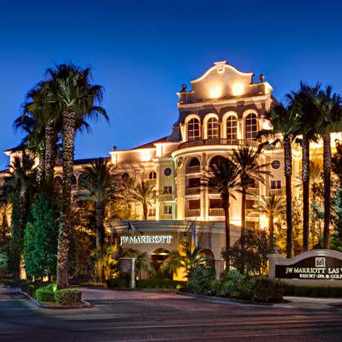
- Summerlin, Las Vegas apartments for rent
- Summerlin North, Las Vegas apartments for rent
- Summerlin West, Las Vegas apartments for rent
- Sun City Summerlin, Las Vegas apartments for rent
- The Lakes, Las Vegas apartments for rent
- West Las Vegas, Las Vegas apartments for rent


 This historic place is located right in the middle of downtown Las Vegas' Fremont Experience. Go inside for a number of bars, restaurants and pools. My favorite is the Shark Tank pool. Get some drinks, lay out and watch the sharks swim circles in their gigantic tank.


 This neighborhood institution takes up almost a city block and has been around for years. Stay close to Fremont street in downtown Las Vegas. Come inside for gambling, restaurants, and entertainment.


 #PioneerPark is along the Lone Mountain nature trail. This is an image of a marker indicating where it is on the trail.


Joseph Castoire
on Pioneer Park