

120 Sigourney Street
Asylum Hill, Hartford, 06105
Commute to Downtown Hartford

Most errands can be accomplished on foot.

Many nearby public transportation options.

Some bike infrastructure.

120 Sigourney Street has a Walk Score of 77 out of 100. This location is Very Walkable so most errands can be accomplished on foot.
120 Sigourney Street is a 13 minute walk from the Hartford Line at the Hartford stop.
This location is in the Asylum Hill neighborhood in Hartford. Nearby parks include Asylum Avenue District Historic District, Asylum Avenue Green and Sigourney Square Park.

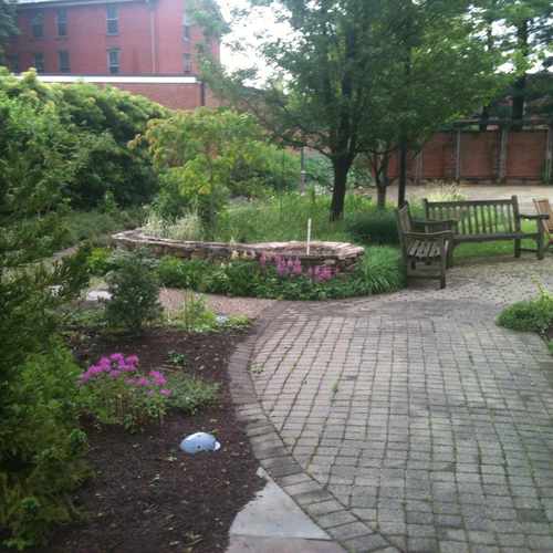
A beautiful garden tucked behind Trinity Episcopal. #asylumhill
Explore how far you can travel by car, bus, bike and foot from 120 Sigourney Street.
120 Sigourney Street has good transit which means many nearby public transportation options.
Rail lines:
Hartford Line
0.6 mi
Bus lines:
161 HOSPITAL CONNECTOR
0.0 mi
60 FARMINGTON AVE
0.1 mi
64 FARMINGTON AVE-SOUTH MAIN ST
0.1 mi
62 FARMINGTON AVE-NORTH MAIN ST
0.1 mi
66 FARMINGTON AVE-UCONN HEALTH
0.1 mi
AH ASYLUM HILL CONNECTOR
0.1 mi
926/927 WINSTED/TORRINGTON EXP
0.1 mi
74 GRANBY ST
0.1 mi
927 TORRINGTON EXP
0.1 mi
901 AVON/CANTON EXP
0.1 mi
120 Sigourney Street is in the Asylum Hill neighborhood. Asylum Hill is the 8th most walkable neighborhood in Hartford with a neighborhood Walk Score of 73.
If you are using a screen reader or having trouble reading this website, please call Walk Score customer service at (253) 256-1634.
© 2026 Walk Score
Kevin Bishop