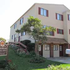
1212 Saint Vincent Street
Oxford Circle - Castor, Philadelphia, 19111
Commute to Downtown Philadelphia
Most errands can be accomplished on foot.
Many nearby public transportation options.
Flat as a pancake, some bike lanes.
About your score
1212 Saint Vincent Street has a Walk Score of 72 out of 100. This location is Very Walkable so most errands can be accomplished on foot.
This location is in the Oxford Circle - Castor neighborhood in Philadelphia. Nearby parks include Jardel Playground, Tarken Playground and Max Myers Playground.
Explore how far you can travel by car, bus, bike and foot from 1212 Saint Vincent Street.
1212 Saint Vincent Street has good transit which means many nearby public transportation options. Car sharing is available from Zipcar and RelayRides.
Rail lines:
Fox Chase Line Fox Chase Line
1.1 mi
Bus lines:
70 Fkd-Gregg/Torr-Cottmn to FRTC
0.2 mi
77 Roosevelt-St Vincent to ChestntHill
0.2 mi
59 Castor-Bustleton to Arrott TC
0.3 mi
Car shares:
1212 Saint Vincent Street compared to all of Philadelphia.
Lower crime area.
Lower crime area.
How do you feel walking near 1212 Saint Vincent Street?
Day:
Night:
Thanks for your feedback!
View all Oxford Circle - Castor apartments on a map.

1212 Saint Vincent Street is in the Oxford Circle - Castor neighborhood. Oxford Circle - Castor is the 45th most walkable neighborhood in Philadelphia with a neighborhood Walk Score of 80.
Moving to Philadelphia from another city? View our moving to Philadelphia guide.
Magee Av & Horrocks St
Living Water United Church-Christ
Al Madina Halal Meat and Grocery Store


If you are using a screen reader or having trouble reading this website, please call Walk Score customer service at (253) 256-1634.
© 2025 Walk Score