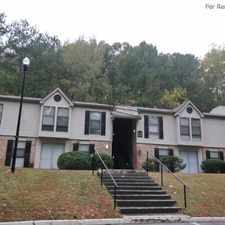
1267 Martin Street Southeast
Most errands require a car.
A few nearby public transportation options.
Flat as a pancake, minimal bike lanes.
Score Details
1267 Martin Street Southeast has a Walk Score of 47 out of 100. This location is a Car-Dependent neighborhood so most errands require a car.
This location is in the South Atlanta neighborhood in Atlanta. Nearby parks include Dainiel Stanton Park, Four Corners Park and Joyland Park.
Explore how far you can travel by car, bus, bike and foot from 1267 Martin Street Southeast.
1267 Martin Street Southeast has some transit which means a few nearby public transportation options. Car sharing is available from RelayRides.
Bus lines:
155 Windsor St./Lakewood Ave.
0.1 mi
55 Jonesboro Rd/Hutchens Rd
0.1 mi
49 McDonough Boulevard
0.3 mi
Car shares:
1267 Martin Street Southeast compared to all of Atlanta.
Average crime area.
Average crime area.
How do you feel walking near 1267 Martin Street Southeast?
Day:
Night:
Thanks for your feedback!
1267 Martin Street Southeast is in the South Atlanta neighborhood. South Atlanta is the 52nd most walkable neighborhood in Atlanta with a neighborhood Walk Score of 52.
Moving to Atlanta from another city? View our moving to Atlanta guide.


If you are using a screen reader or having trouble reading this website, please call Walk Score customer service at (253) 256-1634.
© 2026 Walk Score