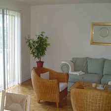
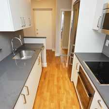
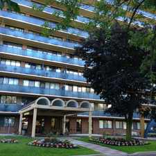
14 Reddins Road
Wexford/Maryvale, Toronto, M1R 4P1
Commute to Downtown Toronto
Most errands require a car.
Many nearby public transportation options.
Flat as a pancake, minimal bike lanes.
About your score
14 Reddins Road has a Walk Score of 49 out of 100. This location is a Car-Dependent neighborhood so most errands require a car.
This location is in the Wexford/Maryvale neighborhood in Toronto. Nearby parks include Cassandra Park, Brookbanks Park and Lynedock Park.
Explore how far you can travel by car, bus, bike and foot from 14 Reddins Road.
14 Reddins Road has good transit which means many nearby public transportation options.
Bus lines:
67 PHARMACY
0.0 km
24 VICTORIA PARK
0.5 km
324 VICTORIA PARK NIGHT BUS
0.5 km
144 DOWNTOWN/DON VALLEY EXPRESS
0.6 km
95 YORK MILLS
0.6 km
395 YORK MILLS NIGHT BUS
0.6 km
View all Wexford/Maryvale apartments on a map.

14 Reddins Road is in the Wexford/Maryvale neighborhood. Wexford/Maryvale is the 86th most walkable neighborhood in Toronto with a neighborhood Walk Score of 67.


If you are using a screen reader or having trouble reading this website, please call Walk Score customer service at (253) 256-1634.
© 2026 Walk Score