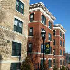
160 Nottingham Street
Most errands require a car.
A few nearby public transportation options.
Score Details
160 Nottingham Street has a Walk Score of 41 out of 100. This location is a Car-Dependent neighborhood so most errands require a car.
This location is in the Liberty Heights neighborhood in Springfield. Nearby parks include Walsh Park, Abbey Brook Ext. and Van Sickle Sch. Athletic Field.
Explore how far you can travel by car, bus, bike and foot from 160 Nottingham Street.
160 Nottingham Street has some transit which means a few nearby public transportation options.
Bus lines:
B6 Ludlow via Bay
0.3 mi
G2 Carew-East Springfield / Belmont-Dwight Rd.
0.3 mi
B15 Oak Grove
0.4 mi
160 Nottingham Street is in the Liberty Heights neighborhood. Liberty Heights is the 10th most walkable neighborhood in Springfield with a neighborhood Walk Score of 59.


If you are using a screen reader or having trouble reading this website, please call Walk Score customer service at (253) 256-1634.
© 2026 Walk Score