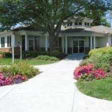
1931 Inkberry Lane
Most errands require a car.
Score Details
1931 Inkberry Lane has a Walk Score of 35 out of 100. This location is a Car-Dependent neighborhood so most errands require a car.
Nearby parks include Bensalem Central Park and James Armstrong Memorial Park.
Nearby schools include Benjamin Rush Elementary School, Robert K Shafer Middle School and de la Salle Vocational School.
The closest grocery stores are Pac Store Distributors, Patel Brothers and Bottom Dollar Food.
Nearby coffee shops include Dunkin' Donuts, Riggins Petroleum and R Cafe and OneCupJoe - Bensalem. Nearby restaurants include Old Friends, Subway and Stefano's II Brick Oven Pizza.
Explore how far you can travel by car, bus, bike and foot from 1931 Inkberry Lane.
Bus lines:
129 Frankford-Knights to Oxford Valley
0.2 mi
128 Neshaminy to Oxford Valley Mall
0.2 mi
Car shares:


If you are using a screen reader or having trouble reading this website, please call Walk Score customer service at (253) 256-1634.
© 2025 Walk Score