
1944 South Street
Philadelphia, Pennsylvania, 19146
Commute to Downtown Camden
Daily errands do not require a car.
World-class public transportation.
Daily errands can be accomplished on a bike.

1944 South Street has a Walk Score of 97 out of 100. This location is a Walker’s Paradise so daily errands do not require a car.
1944 South Street is a 12 minute walk from the PATCO Eastbound to Lindenwold and the PATCO Westbound to Philadelphia at the 15-16th and Locust stop.
This location is in Philadelphia. Nearby parks include 1705 Rodman St. Park, South Square and Catharine Park, Philadelphia, PA.

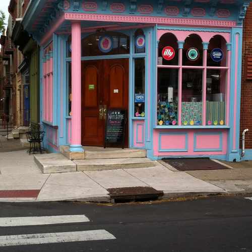
Philly Cupcake's South Street West location!
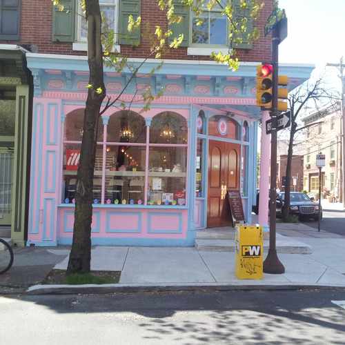

This Philly Cupcake location is new to the area. The already established company recently repainted this old storefront in bright colors and opened its doors.

Kay
Explore how far you can travel by car, bus, bike and foot from 1944 South Street.
1944 South Street is a Rider’s Paradise which means world-class public transportation.
Rail lines:
PATCO Eastbound to Lindenwold
0.5 mi
PATCO Westbound to Philadelphia
0.5 mi
BSL NRG Station to Fern Rock TC
0.5 mi
11 13th-Market to Darby Trans Cntr
0.6 mi
34 13th-Market to 61st-Baltimore
0.6 mi
36 13th-Market to 80th-Eastwick
0.6 mi
13 13th-Market to Yeadon-Darby TC
0.6 mi
10 13th-Market to 63rd-Malvern
0.6 mi
Chestnut Hill West Line Chestnut Hill West Line
0.7 mi
Wilmington/Newark Line Wilmington/Newark Line
0.7 mi
Bus lines:
17 Front-Mkt to 20-Johnston/Broad-Pat
0.0 mi
40 2nd-Lombard to Conshohocken-Monumnt
0.0 mi
This location is in the city of Philadelphia, PA. Philadelphia has an average Walk Score of 75 and has 1,526,006 residents.

Hutchinson Street
The Liberty Bell
Stinger Square Park
If you are using a screen reader or having trouble reading this website, please call Walk Score customer service at (253) 256-1634.
© 2026 Walk Score
Marcus Ferreira