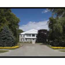
19649 Greenwald Drive
Almost all errands require a car.
Score Details
19649 Greenwald Drive has a Walk Score of 13 out of 100. This location is a Car-Dependent neighborhood so almost all errands require a car.
This location is in Southfield. Nearby parks include O'Hair Park, Tuttle Playground and Votrobeck Playground.
Nearby schools include Southfield Regional Academic Campus, Faith Christian Academy and Brace-Lederle K-8 School.
The closest grocery stores are Foodland and Plum Hollow Super Market.
Nearby restaurants include Wendy's, SUBWAY® Restaurants and Checkers Drive-In Restaurant.
19649 Greenwald Drive is near Brace Park, Bauveric Woods Nature Preserve and Lawrence Technological University.
Explore how far you can travel by car, bus, bike and foot from 19649 Greenwald Drive.
Bus lines:
17 EIGHT MILE
0.6 mi
60 EVERGREEN
0.6 mi
16 DEXTER
1.0 mi
46 SOUTHFIELD
1.0 mi
View all Southfield apartments on a map.

Popular apartment searches include fitness, pool and hardwood floor. View all Southfield apartments and rentals.
This location is in the city of Southfield, MI. Southfield has an average Walk Score of 35 and has 71,739 residents.
Learn More About Southfield


If you are using a screen reader or having trouble reading this website, please call Walk Score customer service at (253) 256-1634.
© 2026 Walk Score