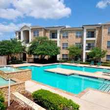
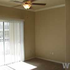
2411 Rivas Street
Most errands require a car.
A few nearby public transportation options.
Flat as a pancake, minimal bike lanes.
Score Details
2411 Rivas Street has a Walk Score of 49 out of 100. This location is a Car-Dependent neighborhood so most errands require a car.
This location is in the Prospect Hill neighborhood in San Antonio. Nearby parks include Rosedale Park, Holy Cross of San Antonio School Baseball Field and Holy Cross Stadium.
Nearby schools include Holy Cross High School, Gus Garcia Middle School and Fenwick Elementary School.
The closest grocery stores are Celorio, Northwest Food Center Inc and H-E-B.
Nearby coffee shops include Ramona's Cafe and Don Gilberto's Cafe. Nearby restaurants include Juanito's Mexican Restaurant, Porky's Burgers and More and La Playa Restaurant.
2411 Rivas Street is near Rosedale Park, Jose Navarro Park and West End Park.
There are minimal bike lanes and the terrain is flat as a pancake. 2411 Rivas Street is somewhat bikeable, there is minimal bike infrastructure.
Explore how far you can travel by car, bus, bike and foot from 2411 Rivas Street.
2411 Rivas Street has some transit which means a few nearby public transportation options.
Bus lines:
77 MARTIN
0.1 mi
277 MARTIN/RUIZ 77-79 LU
0.1 mi
524 GENERAL McMULLEN Frequent
0.2 mi
79 RUIZ Frequent
0.3 mi
2411 Rivas Street is in the Prospect Hill neighborhood. Prospect Hill is the 9th most walkable neighborhood in San Antonio with a neighborhood Walk Score of 62.
Moving to San Antonio from another city? View our moving to San Antonio guide.


If you are using a screen reader or having trouble reading this website, please call Walk Score customer service at (253) 256-1634.
© 2026 Walk Score