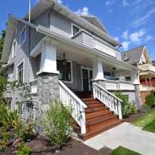
1234 Pendrell Street
Commute to Downtown Vancouver
Daily errands do not require a car.
World-class public transportation.
Mostly flat, excellent bike lanes.
About your score
1234 Pendrell Street has a Walk Score of 98 out of 100. This location is a Walker’s Paradise so daily errands do not require a car.
1234 Pendrell Street is a 16 minute walk from the Expo Line EXPO SKYTRAIN at the BURRARD STATION PLATFORM 1 stop.
This location is in the West End neighborhood in Vancouver. Nearby parks include Nelson Park, Barclay Heritage Square and Sunset Beach Park.
Explore how far you can travel by car, bus, bike and foot from 1234 Pendrell Street.
1234 Pendrell Street is a Rider’s Paradise which means world-class public transportation. Car sharing is available from Zipcar.
Rail lines:
Expo Line EXPO SKYTRAIN
1.0 km
Canada Line CANADA LINE SKYTRAIN
1.1 km
980 CANADA LINE SkyTrain
1.2 km
WCE WEST COAST EXPRESS
1.6 km
Bus lines:
006 DAVIE/DOWNTOWN
0.1 km
023 MAIN ST STN/YALETOWN/BEACH
0.4 km
N22 DOWNTOWN/MACDONALD NIGHTBUS
0.5 km
032 DUNBAR/DOWNTOWN
0.5 km
002 MACDONALD/DOWNTOWN
0.5 km
044 UBC/DOWNTOWN
0.5 km
Car shares:
Bike shares:
1234 Pendrell Street is in the West End neighborhood. West End is the 2nd most walkable neighborhood in Vancouver with a neighborhood Walk Score of 94.

English Bay Anchorages #1-17
Sunset Beach
Vancouver Laughing Statues


If you are using a screen reader or having trouble reading this website, please call Walk Score customer service at (253) 256-1634.
© 2024 Walk Score