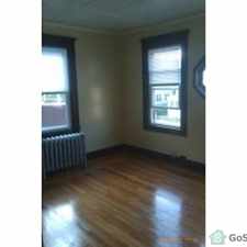
33 Kane Street
Some errands can be accomplished on foot.
It is possible to get on a bus.
Score Details
33 Kane Street has a Walk Score of 65 out of 100. This location is Somewhat Walkable so some errands can be accomplished on foot.
This location is in the Sixteen Acres neighborhood in Springfield. Nearby parks include Greenleaf Park, Wetstone Tract and Venture Pond Cons. Area.
Nearby schools include Mill Pond School, Kathleen Thornton School and Mary M Walsh Elementary School.
The closest grocery store is Fresh Acres Market.
Nearby coffee shops include Pride, Dunkin' Donuts and Dunkin' Donuts. Nearby restaurants include Ginger Blossom, Wings Over and Bruno's Pizza 16 Acres.
33 Kane Street is near Greenleaf Park, Wetstone Tract and Venture Pond Cons. Area.
Explore how far you can travel by car, bus, bike and foot from 33 Kane Street.
33 Kane Street has minimal transit which means it is possible to get on a bus.
Bus lines:
B17 Eastfield Mall via Worthington-Wilbraham Rd-Parker
0.0 mi
R27 Wilbraham/Eastfield Mall/Sixteen Acres
0.1 mi
View all Sixteen Acres apartments on a map.


Popular apartment searches include hardwood floor and fireplace.
33 Kane Street is in the Sixteen Acres neighborhood. Sixteen Acres is the 17th most walkable neighborhood in Springfield with a neighborhood Walk Score of 28.


If you are using a screen reader or having trouble reading this website, please call Walk Score customer service at (253) 256-1634.
© 2026 Walk Score